CAVU Aerospace UK Ltd

BIODIVERSITY

We can have BNG (Biodiversity Net Gain) counted behind the desk, using space data!
Space can provide 30cm resolution imagery for several times a week. So, owners can monitor project development efficiently with a fraction of the cost.
CAVU Aerospace pickup high resolution satellite imagery of your project from satellite companies and process data for project developers. Space Tech effectively helps to have a Better Earth!

BIODIVERSITY - 597 by 679 pixels

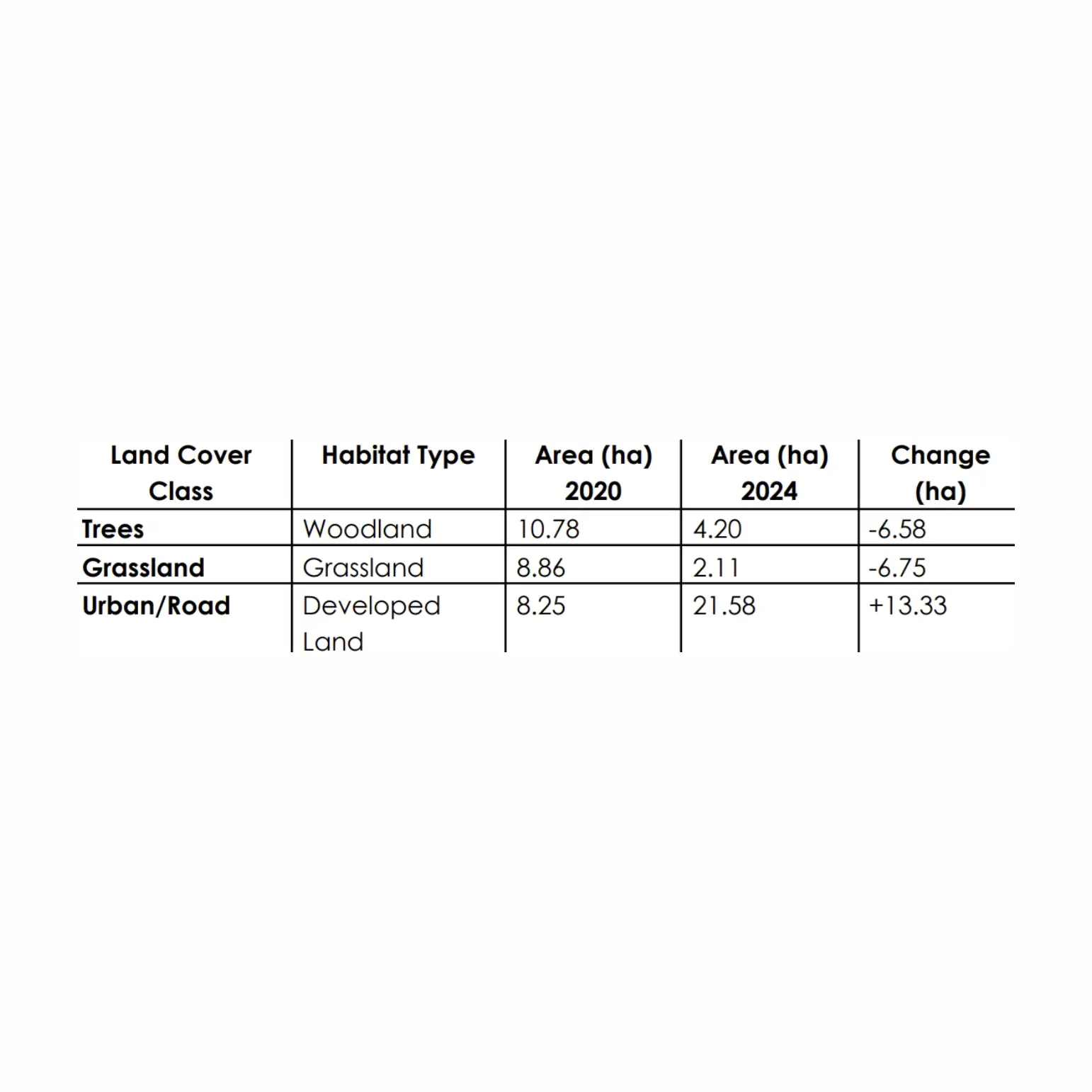
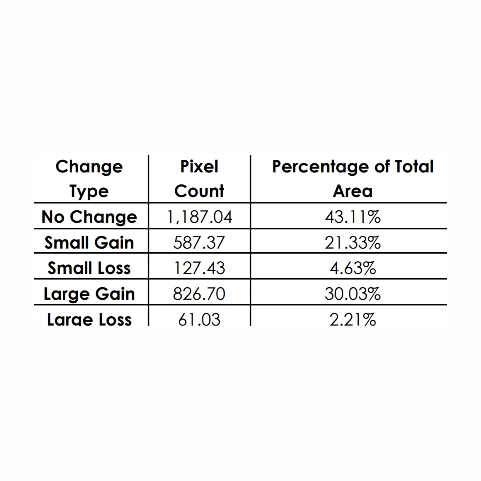
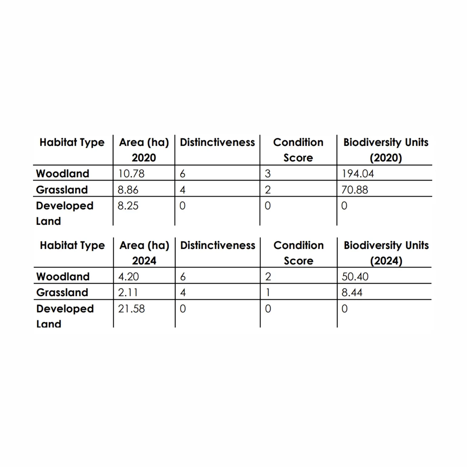
Satellite imagery obviously should not be used in conjunction with field checks by ecologists. BNG assessments use satellite imagery and computer algorithms to analyze how development projects impact biodiversity. Satellite data can be helpful for BNG because it can: Monitor large areas, Analyze trends, reduce costs, Integrate diverse data, & Monitor species in quick time. Machine learning techniques also can make it better & better to use.

For more information & full report for sample development projects, Please contact us.