If 30 cm is enough resolution for your mapping, inspection, biodiversity or measurement projects, you don’t have to hire a drone company or site survey! With Space Tech, you can have 3D models & DEM mapping in few seconds & fraction of the costs!
This is how it works:
Inputs from client: Coordinates of Point of interest
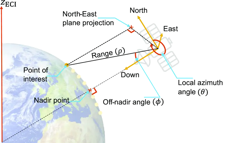
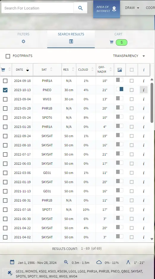
Process:: At least 3 available satellites imagery with different off-nadir angles (0-10 deg & 12.5-15 deg), calculate dimensions taking into account Off-Nadir angles, sun- elevation angle, Resolution, Pixels, Orbit, Local azimuth angle, Capture date etc.
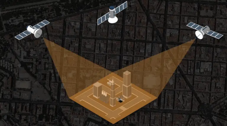
Combining images captured at different Off Nadir Angles is used to produce stereo imagery. In this case, an area of interest is collected from two or more angles and delivered as a single set of data to give an incredibly accurate elevation dataset and minimise hidden features. If the target is captured from three angles, it’s called tri-stereo imagery.